
Trail Planning and Wilderness Navigation Across Canada
Detailed guides on reading topographic maps, planning multi-day routes, and staying safe in Canadian backcountry terrain — from the Coast Mountains to the Laurentian Highlands.
Read Trail Planning Guide About UplandNest
Recent Articles

Topographic Maps Are Not Optional
In Canadian backcountry, cell service disappears past the trailhead. Knowing how to read a 1:50,000 NTS sheet — contour intervals, magnetic declination, UTM grids — is the single skill that distinguishes a hiker who handles a route change from one who doesn't.
Read the GuideKey Areas Covered on UplandNest
The guides here focus on practical knowledge for extended trips into Canadian wilderness — organized around the three skills that matter most before and during a backcountry outing.
Map and Compass Navigation
Reading NTS topographic sheets, understanding contour lines, declination correction, and triangulating position without GPS.
Route Planning and Permits
Selecting suitable routes by season, understanding Parks Canada reservation requirements, and building realistic daily distance targets on variable terrain.
Backcountry Safety
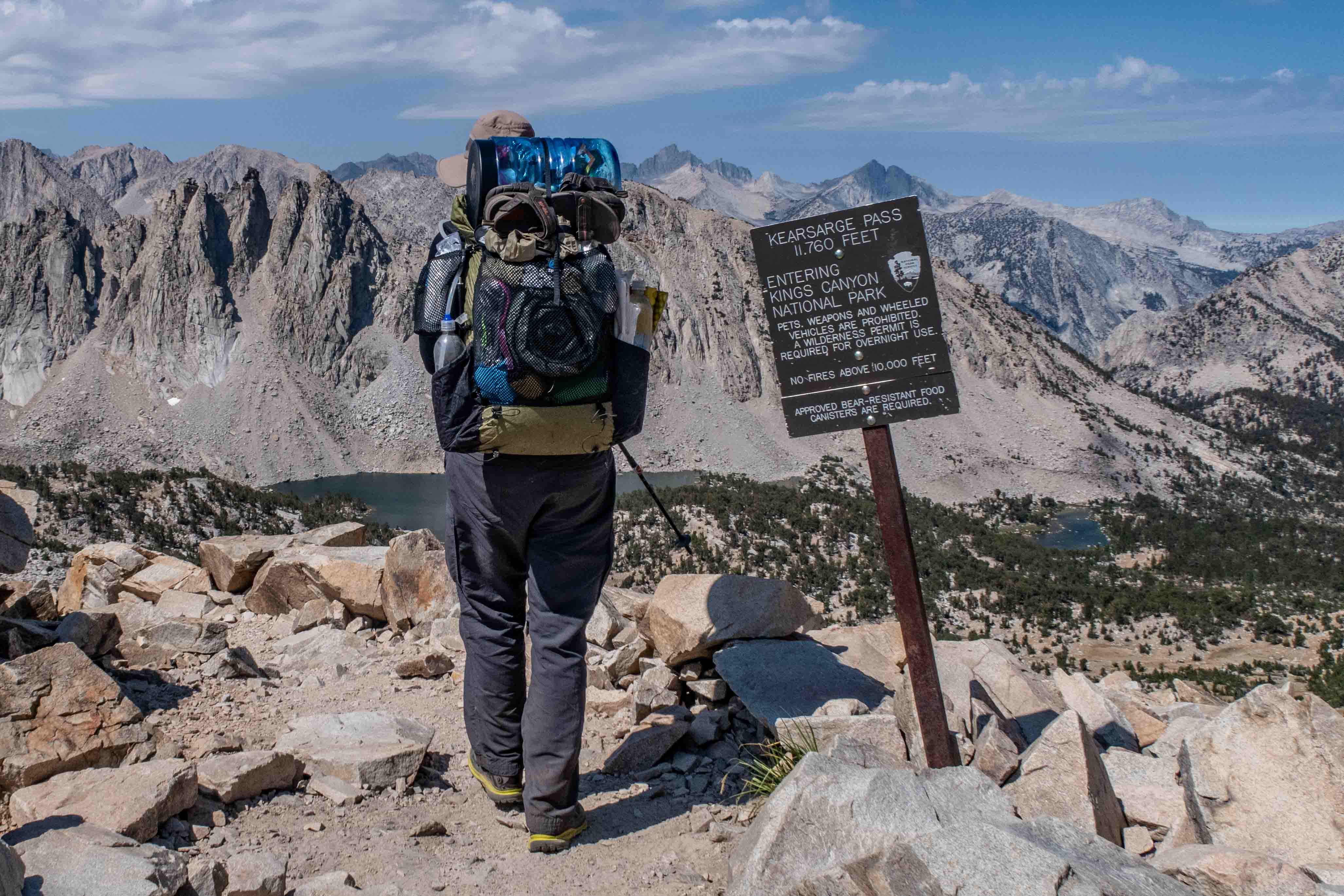
Bear canister regulations, wildlife encounter protocols, emergency signalling, and weather pattern recognition in mountain and boreal environments.
Planning a Multi-Day Route in Canada
From the West Coast Trail on Vancouver Island to the Laugavegur-equivalent circuits in Jasper, a multi-day Canadian backcountry trip requires advance booking, a layered weather strategy, and a realistic understanding of how elevation gain changes pace estimates.
Trail Planning GuideExternal References Worth Knowing
The most reliable data for Canadian backcountry planning comes from federal and provincial sources — topographic data, trail conditions, and wildlife zone maps updated each season.
Natural Resources Canada
Free 1:50,000 and 1:250,000 NTS sheets covering every region of Canada. The authoritative source for topographic data.
Parks Canada Reservations
Backcountry campsite and permit reservations for national parks open on a fixed date each spring. Advance planning is essential.
Alpine Club of Canada
Route condition reports, hut bookings, and technical climbing information for alpine terrain across British Columbia and Alberta.